The Most Beautiful Place on Earth
With special thanks to Pam Floyd and Ted Spears for contributing to this article

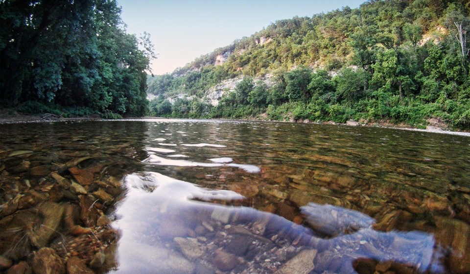
America’s First National River, Wild and Scenic River, the Jewel of the Ozarks; these are all terms that describe the Buffalo National River as it winds its way through the untamed and beautiful Ozarks of northwest Arkansas. Flowing from its headwaters high in the Boston Mountains, this stunning river flows freely nearly 150 miles before emptying into the White River near Buffalo City. In an effort to protect the pristine quality of the river and to preserve it as a free-flowing stream, Congress declared it as our country’s first national river in 1972 and placed it under the protection of the National Park Service. Today the Buffalo National River encompasses almost 96,000 acres of rugged mountain terrain, massive limestone bluffs, deep hollows, lush, gently rolling valleys, and every year it provides thousands of devoted hikers, floaters, campers and horseback riders a place of refuge and relaxation.

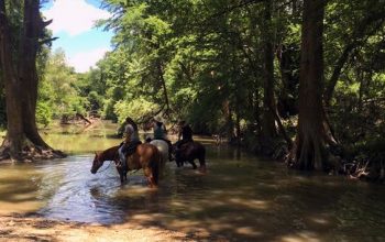
Members of a local volunteer group, the Buffalo River Back Country Horsemen of America, speak for many repeat visitors when they say that their finest hours are spent exploring along the river and into the deep canyons and dense forests that surround it. According to these dedicated horsemen and women, one of the best ways to experience some of the most scenic and remote areas of the Buffalo is from the back of a good horse. Thundering springtime waterfalls, profusions of ephemeral wildflowers, mysterious old home places, deep, blue-green pools, and herds of bugling elk – from the road you may only get a glimpse of these and other treasures that lie tucked within these hills, but wandering the trails on horseback, you come to really know them. And, whether you’re looking for a developed campground or a wilderness experience, the Buffalo has a place for you.
Some of the trails meander gently crisscrossing the river many times; others are narrow, steep and challenging, allowing for plenty of adventure. In a perfect blend of work and play, members of Buffalo River BCHA (which includes two chapters, serving both the upper and lower river) meet regularly to clear and maintain the trails of the Buffalo.
“The Buffalo is one of my favorite places to ride. Lots of trails from easy to very challenging depending on what you like. I believe I’ve been on most of them,” states Lori Zakas Allred
According to the National Park Service, there are more than 75 miles of designated equestrian trails. The most extensive horse trail network is in the upper section of the river. Due to the extensive network of trails, horseback riders are advised to purchase a Trails Illustrated® map published by National Geographic from any of the park visitor centers, park concessionaires, area Arkansas Game & Fish Commission offices, or local area businesses to properly identify park approved equestrian trails.

The Park’s Wilderness areas are managed as natural areas where man is but only a visitor. The forces of nature determine the trail conditions to a greater degree than in other areas of the national river. Be prepared for swollen streams, washouts, downed trees and trail obstacles that may require dismounting during any time of the year. Many of the trails along the Buffalo River are designated for both hiking and equestrian use. Shared use equestrian trails are marked with a yellow blaze. Please keep horses off trails marked with a white blaze and designated for hiking only. Many of these trails are extremely steep and are not designed or safe for equestrian travel. Each visitor should make decisions and choose practices that will minimize damage to help preserve the natural and cultural landscape of the river.

The following trails are designated horse trails: Bench Trail, Cecil Cove, Old River Trail (ORT), Centerpoint, Chimney Rock, Sneeds Creek, Buffalo River Trail from Woolum to Gilbert only, and the Cow Creek-Cook Hollow Loop Trail (Hathaway Trailhead).
Traditionally, canoes and other watercraft have the right-of-way at river crossings, and horseback riders have the right-of-way when meeting hikers. Dogs are not allowed on horse trails. Horses should not be tied directly to trees. Use a “high picket line” rigged outside of your camp area or hitch racks where provided.
“Growing up I was always either by or on the Buffalo River. It offered so much to me as a kid, and now for me as an adult it offers beautiful trails to ride. In a world that is so busy and always pushing people for more, riding the river is a sweet release from all of that.
From the huge bluffs of Steel Creek to the crystal clear waters of Sneed Creek and on to my favorite, Granny Henderson’s cabin where you will find history that speaks to you, the Buffalo River has it all. The winding trails of Ozark and Pruitt are the ones I get to ride the most and they always have something new to offer. There is history along with beauty on every ride. Whether I am riding with those who have ridden 30,000 miles plus or those who are newer to riding these trails, every ride is always a treasured memory I will never forget. I love this place and I can’t help but to feel that it loves me back,” Christy Lawson

Designated trails for horseback riding are located in all districts of the national river. Two camping areas in the upper river have been designated for visitors with horses. These areas, at Steel Creek and Erbie, are accessible by vehicle. Middle river horse users may overnight at Woolum. Visitors to the Lower Buffalo Wilderness Area may camp at Big Creek or Hathaway Gap Trailheads.
For more information about places to camp or ride on the Buffalo National River, contact the Back Country Horsemen of Arkansas: arkansasbch.org/trails/
HORSE CAMPS
Centerpoint Horse Camp
located directly across Hwy 43 from the Centerpoint Trailhead
Website: www.centerpointhorsecamp.com
Caney Mountain Horse Camp
surrounded by the Sylamore National Forest, Lower Buffalo Wilderness Area, and Leatherwood Wilderness Area
Website: www.caneymountain.com
Steel Creek Campground
upper district, about 3 miles east of Ponca, Arkansas, off of Highway 74
Website >>
GPS Coordinates: 36.0407758, -93.3440483
TRAIL MAPS
• Ponca Wilderness Trails
• Kyle’s Landing to Pruitt Trails
• Woolum to Tyler Bend
• Gilbert Area Trails


